Magome to Tsumago Hiking Trail Video
This video shows you the route from Magome to Tsumago. In this video, you can see how to walk the route and the highlights of the one.
Giving the directions from Magome to Tsumago
This article shows you the way from the southern tip of Magome-Juku to the northern tip of Tsumago-Juku via Magome Pass with the photos. The way is part of Nakasendo Way and also quite popular among foreign tourists. The total length is about 8.4 km. It takes about two hours on foot without stopping on the way.
Note
- In this article, you can enjoy virtual hiking.
- "Intersection", "Crossroad", "T in the road", and "Fork in the road" are all called "Juncture" in this article.
- The time it takes to get to each point is just a reference.
- Go straight at all the junctures that aren't described below.
- Reproducing all or any part of the contents is prohibited.
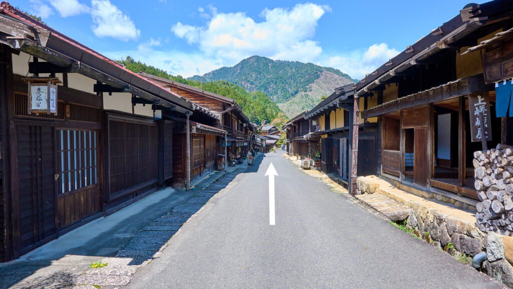
The southern tip of Magome-Juku
It's close to Magome Bus Stop.
Go up the hill in the middle of the following photo.
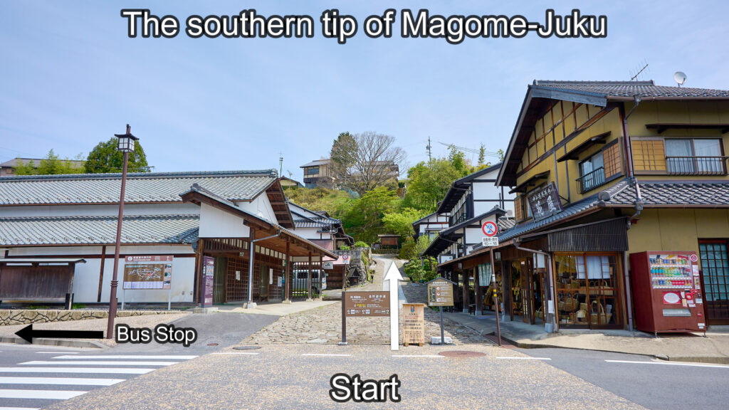
The southern tip of Magome-Juku
Magome-Juku Masugata
1-minute walk from the southern tip of Magome-Juku.
Bear left.
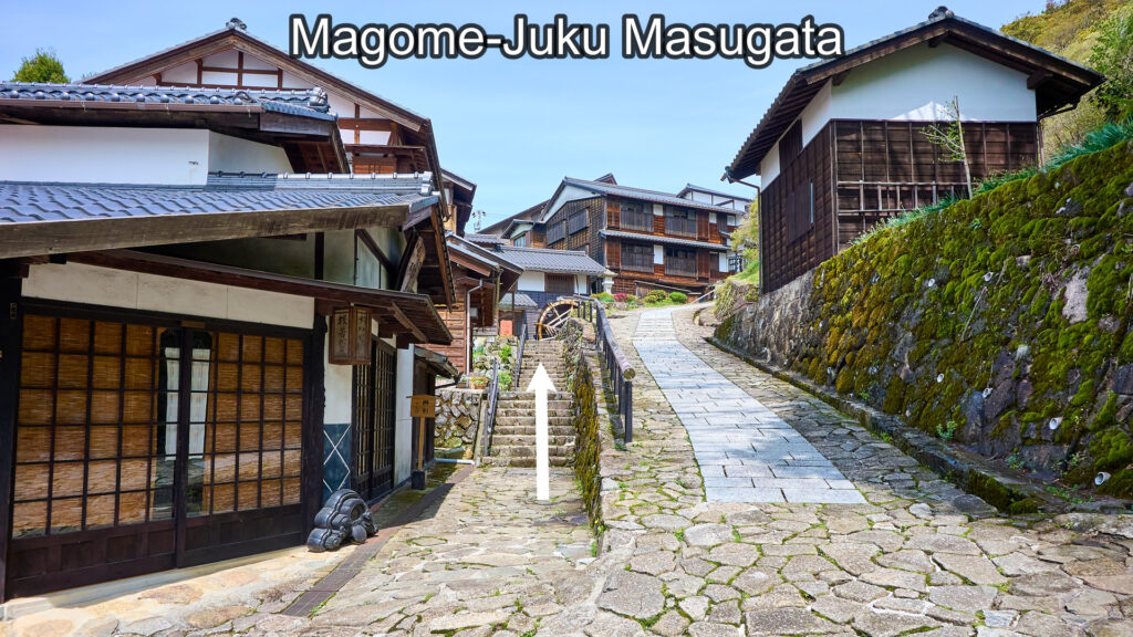
Magome-Juku Masugata
Shimizuya Museum
3-minute walk from the southern tip of Magome-Juku.
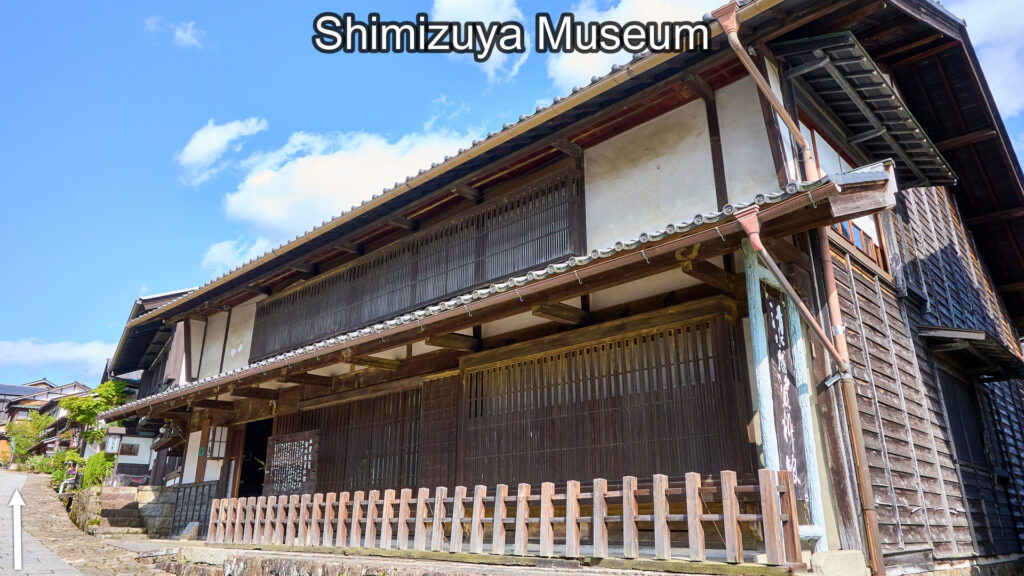
Shimizuya Museum
Eisyou-Ji Temple Juncture
4-minute walk from the southern tip of Magome-Juku.
Go straight. (FYI: Turn left and walk 160 meters. Then, you'll find Eisyou-Ji Temple.)
Eisyou-Ji Temple Juncture
Toson Shimazaki Memorial Museum
5-minute walk from the southern tip of Magome-Juku.
It was built on the site of Magome-Juku Honjin. It's the mecca for lovers of Toson's literature.
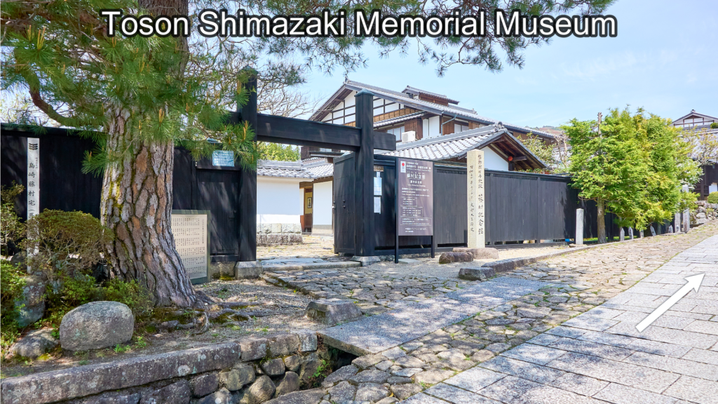
Toson Shimazaki Memorial Museum
Waki-Honjin Museum
6-minute walk from the southern tip of Magome-Juku.
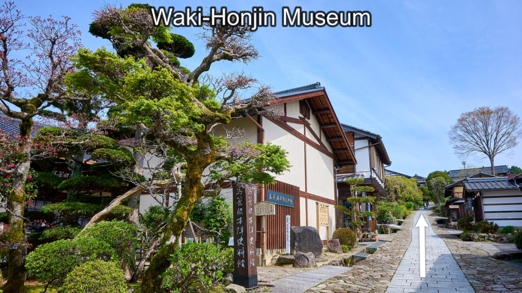
Magome Waki-Honjin Museum
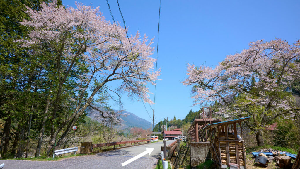
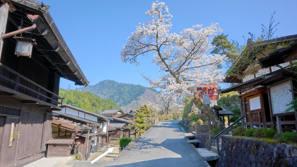
Magome-juku Cherry Blossom Tree
7-minute walk from the southern tip of Magome-Juku.
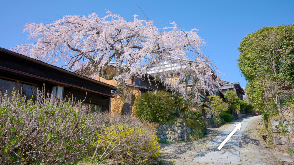
Magome-Juku Cherry Blossom
The northern tip of Magome-Juku
9-minute walk from the southern tip of Magome-Juku.
Go straight.
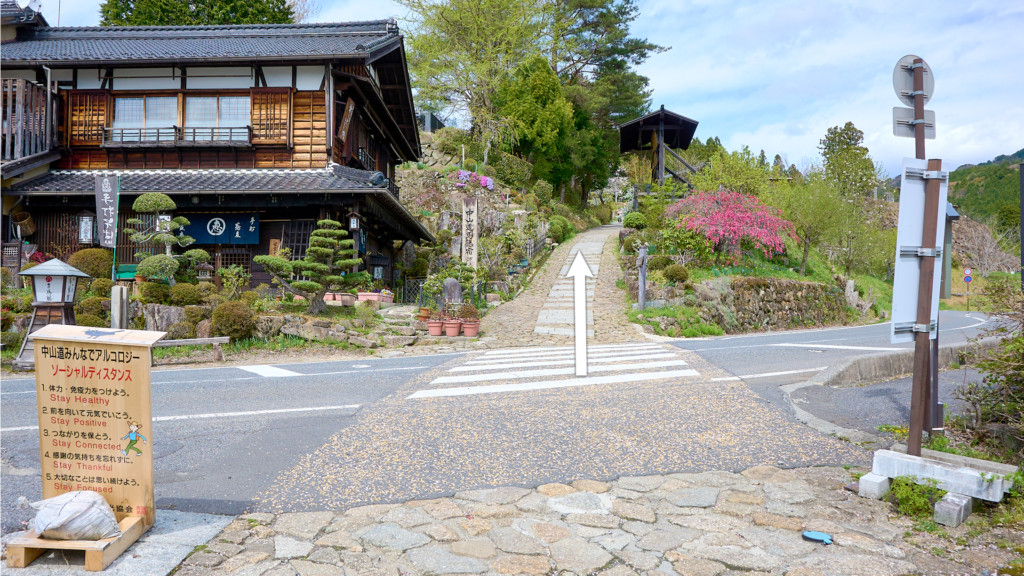
The northern tip of Magome-Juku
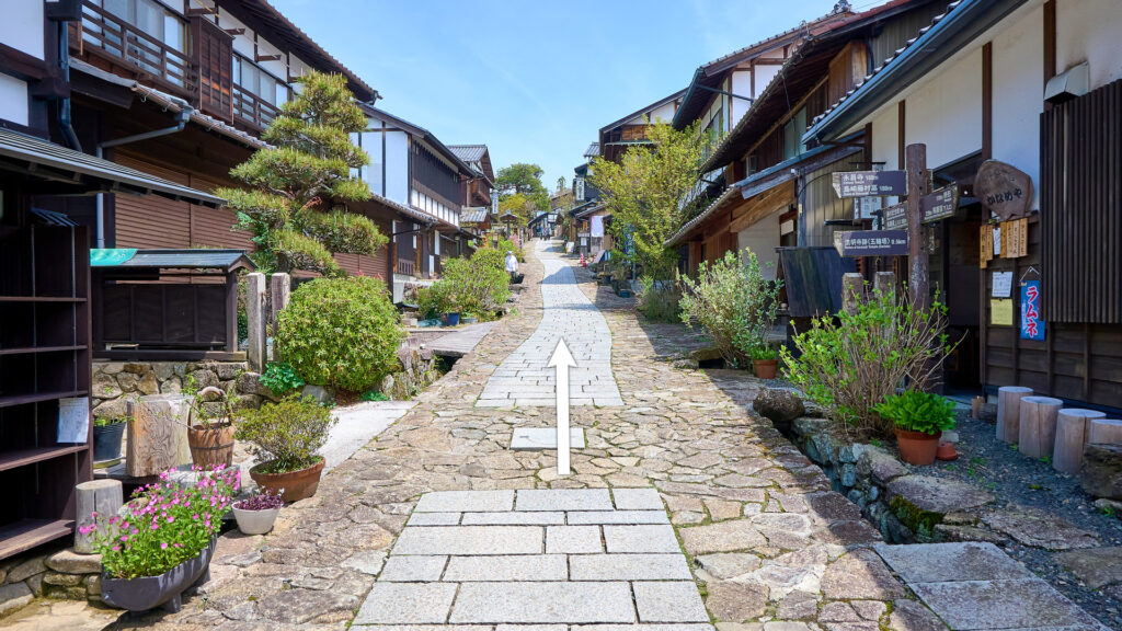
The vicinity of the square 2
11-minute walk from the southern tip of Magome-Juku.
Go along the stone-paved path in the middle of the following photo.
(FYI: There is a square on the right of the following photo. From the square, you can see Mt.Ena if it's not hidden by clouds.)
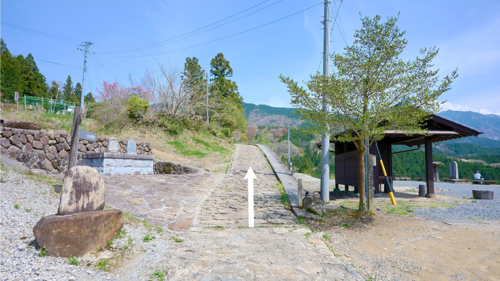
The vicinity of the square 2
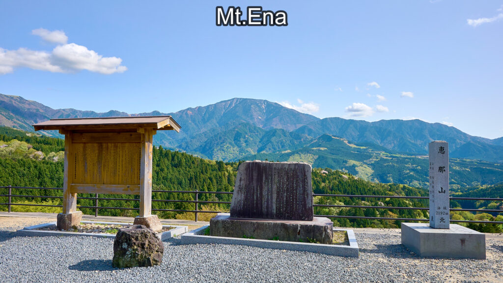
Mt.Ena
The vicinity of the square 3
12-minute walk from the southern tip of Magome-Juku.
Turn right and go down the stairs.
The vicinity of the square 3
The vicinity of the square 4
13-minute walk from the southern tip of Magome-Juku.
Go straight.
The vicinity of the square 4
The stone stairs
14-minute walk from the southern tip of Magome-Juku.
Go up the stairs. After going up the stairs, you'll find a downhill. Go down the hill.
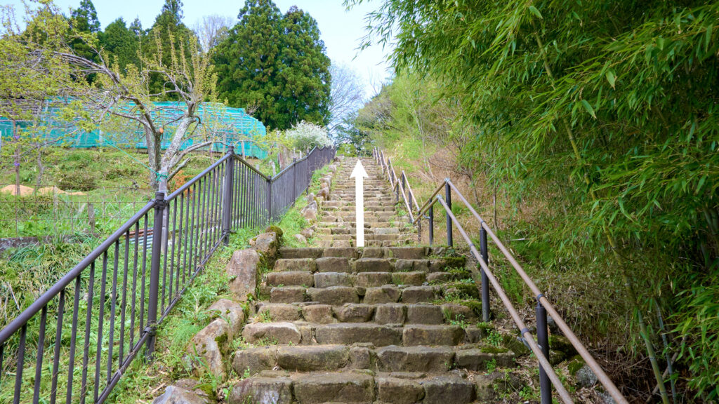
The stone stairs
Magome Juncture 1
17-minute walk from the southern tip of Magome-Juku.
Turn onto the prefectural road and go straight. (Cross the road and walk on the right sidewalk.)
Magome Juncture 1
Magome Juncture 2
19-minute walk from the southern tip of Magome-Juku.
Turn off the prefectural road onto the right path.
Magome Juncture 2
Magome Juncture 3
20-minute walk from the southern tip of Magome-Juku.
Go along the left path. (There is a bridge with the white guardrails in the following photo. Don't cross the bridge.)
Magome Juncture 3
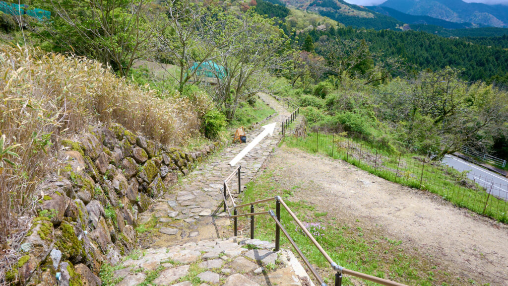
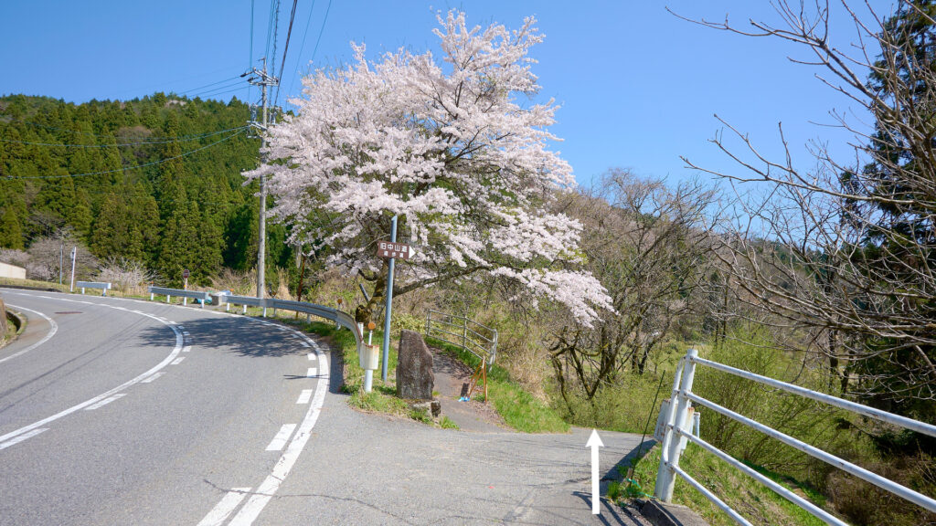
Nashinokizaka Juncture 1
24-minute walk from the southern tip of Magome-Juku.
Go straight and go up the stone-paved hill (Nashinokizaka).
There is a watermill and a watermill monument in the following photo. The watermill is in the middle and the watermill monument is on the left.
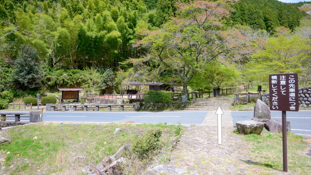
Nashinokizaka Juncture 1
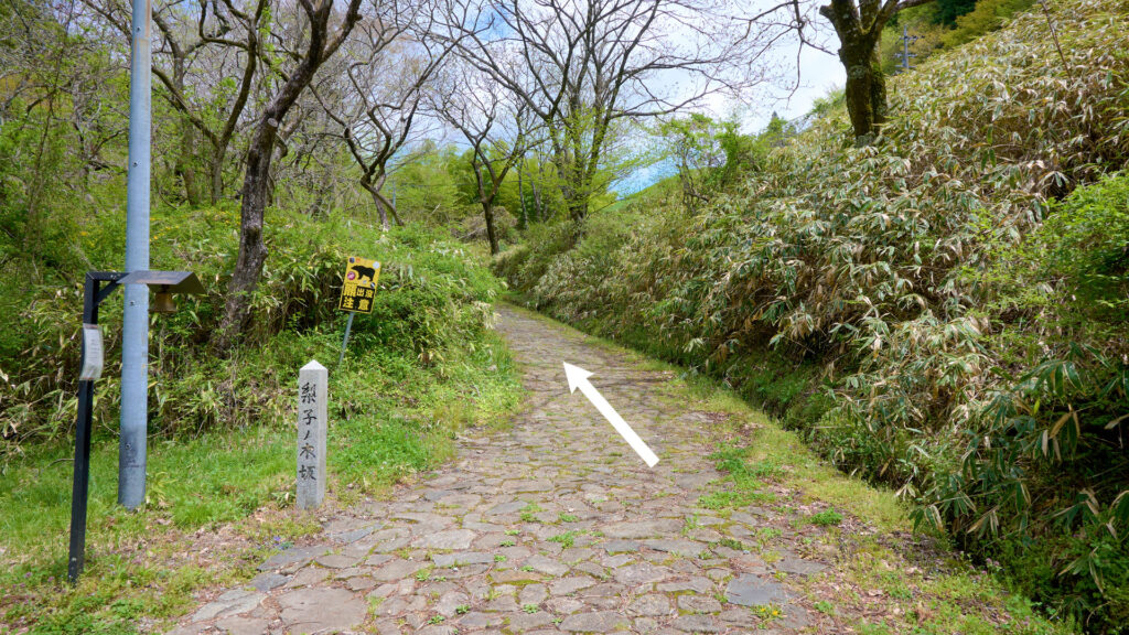
Nashinokizaka
Nashinokizaka Juncture 2
27-minute walk from the southern tip of Magome-Juku.
Turn onto the prefectural road and go straight.
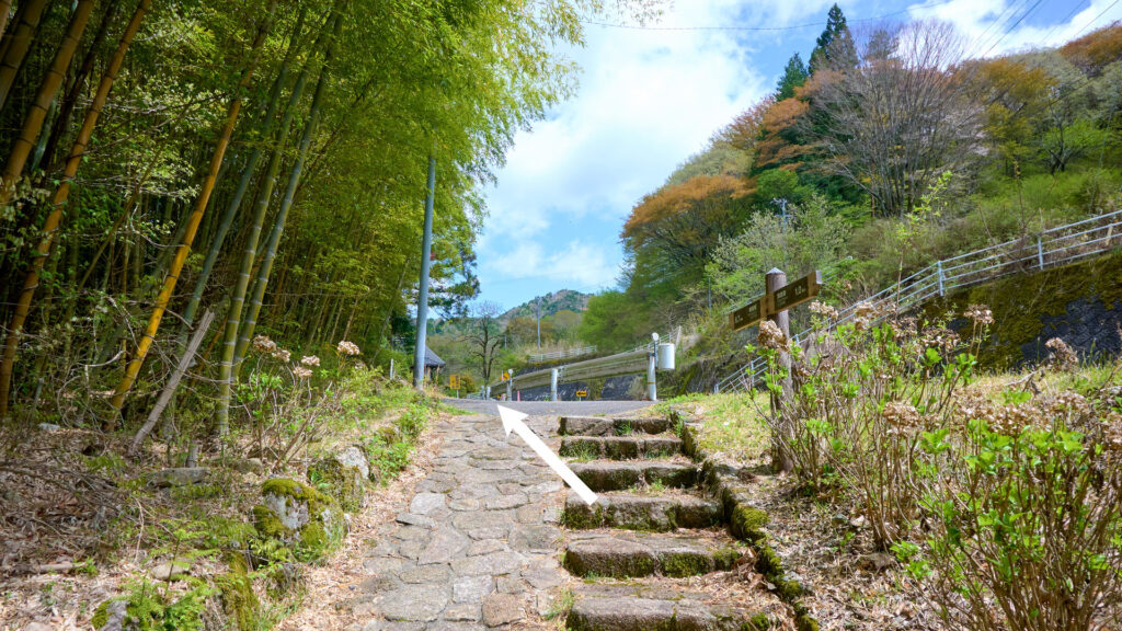
Nashinokizaka Juncture 2
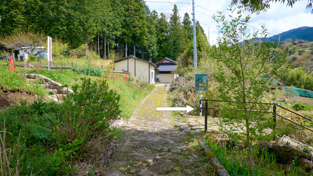
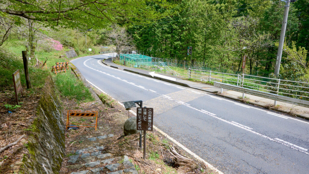
Shimizu Juncture 1
29-minute walk from the southern tip of Magome-Juku.
Turn off the prefectural road onto the right path. (The path is in the middle of the following photo.)
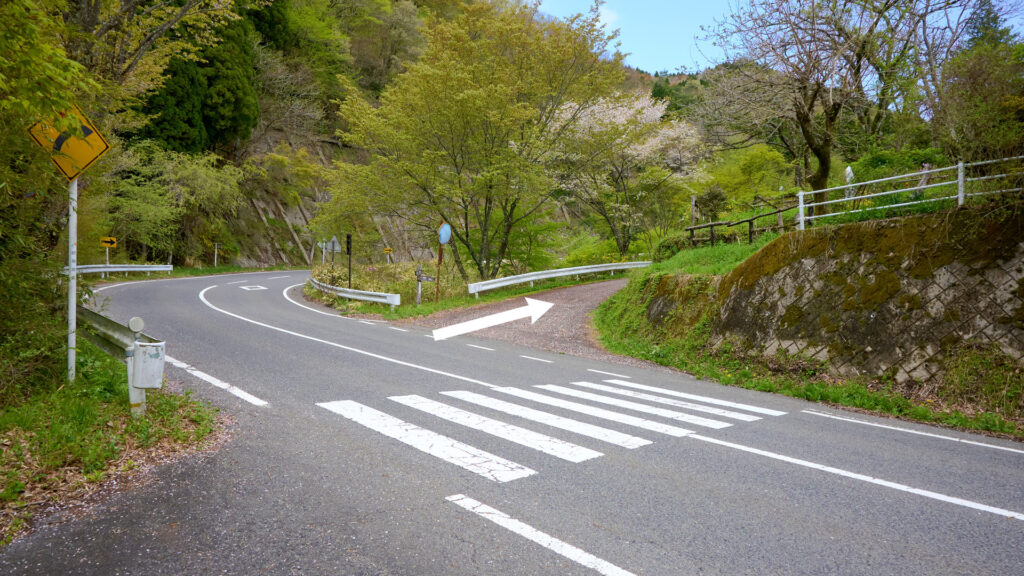
Shimizu Juncture 1
Shimizu Juncture 2
30-minute walk from the southern tip of Magome-Juku.
Go straight.
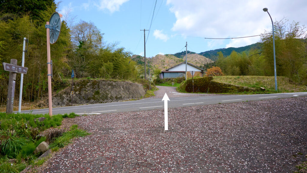
Shimizu Juncture 2
The vicinity of Juppensya Ikku Tanka monument
33-minute walk from the southern tip of Magome-Juku.
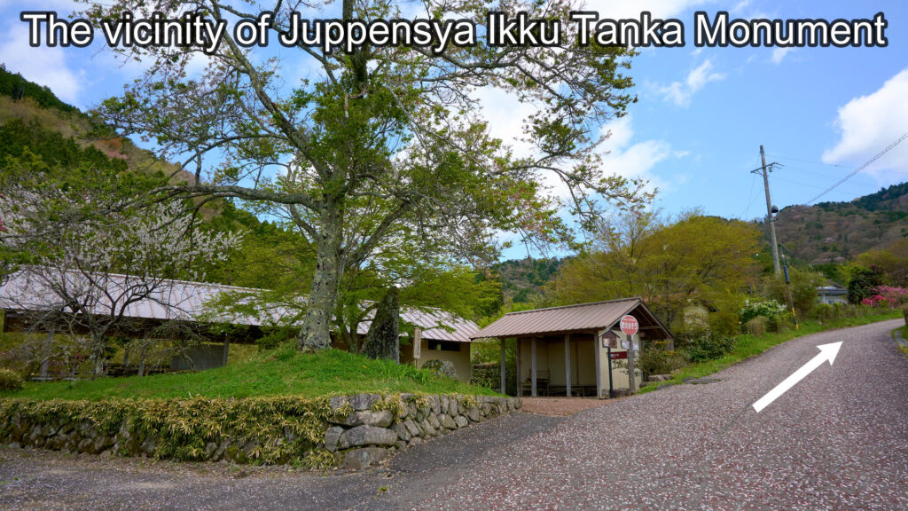
The vicinity of Juppensya Ikku Tanka Monument
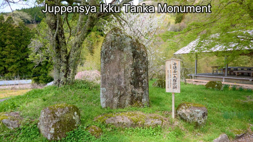
Juppensya Ikku Tanka Monument
The vicinity of Head Carrier Of The Pass Monument
35-minute walk from the southern tip of Magome-Juku.
Go straight. (Don't turn right.)
"Village On The Pass" is around here.
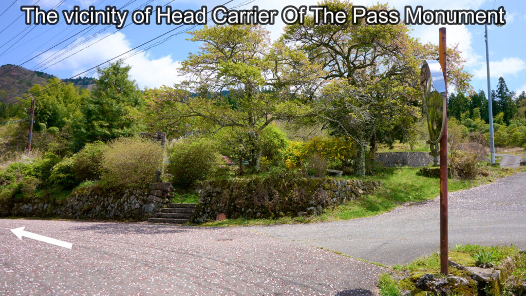
The vicinity of Head Carrier Of The Pass Monument
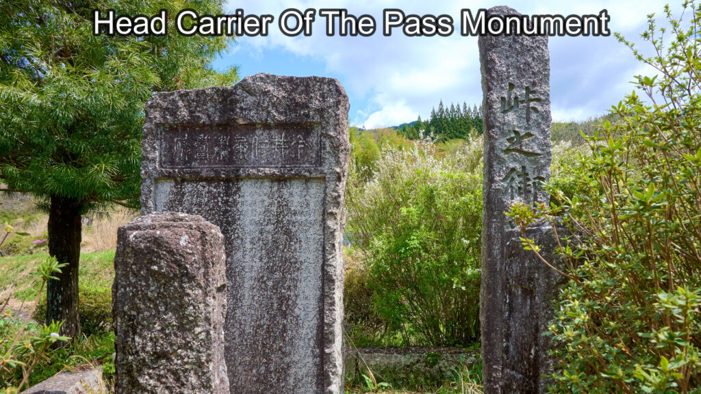
Head Carrier Of The Pass Monument
The Imais House
37-minute walk from the southern tip of Magome-Juku.
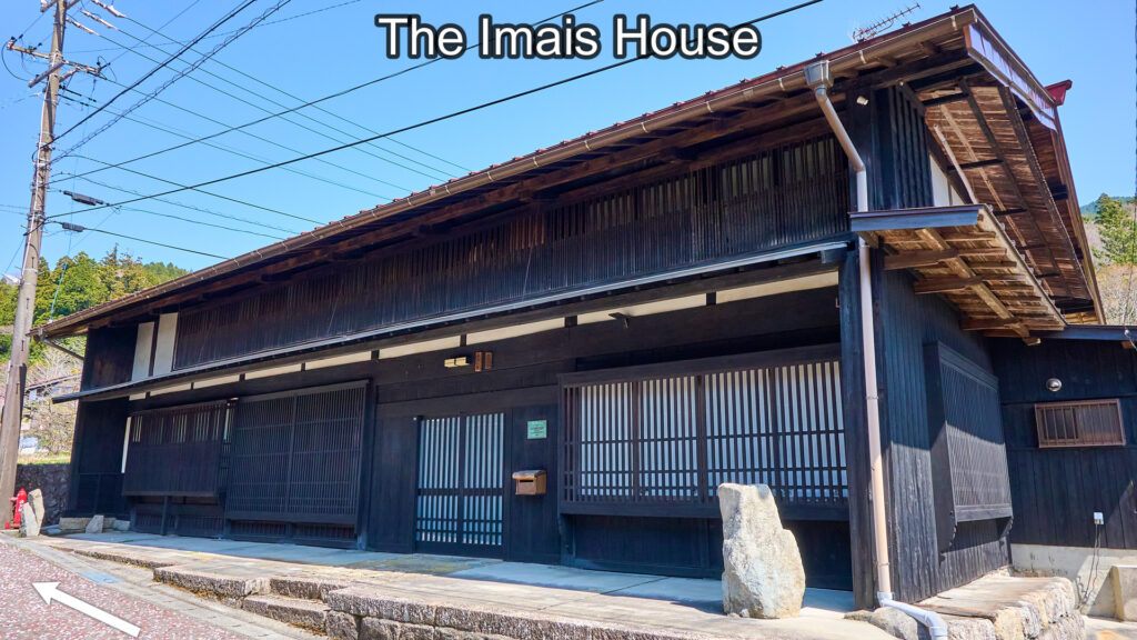
The Imais House
"Village On The Pass" Juncture 1
It's near the Imais House.
go straight.
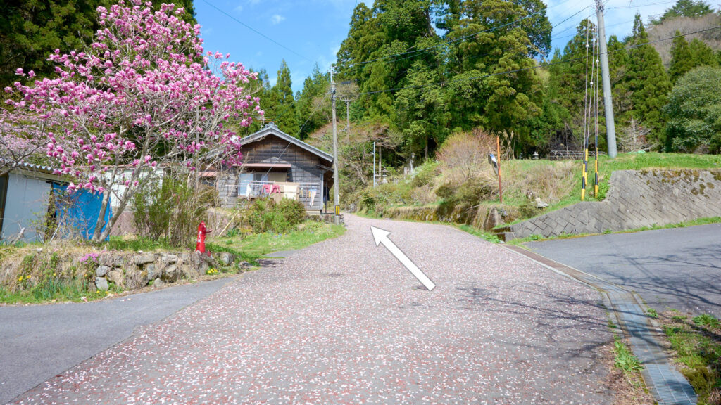
"Village On The Pass" Juncture 1
The vicinity of Kumano Shrine
39-minute walk from the southern tip of Magome-Juku.
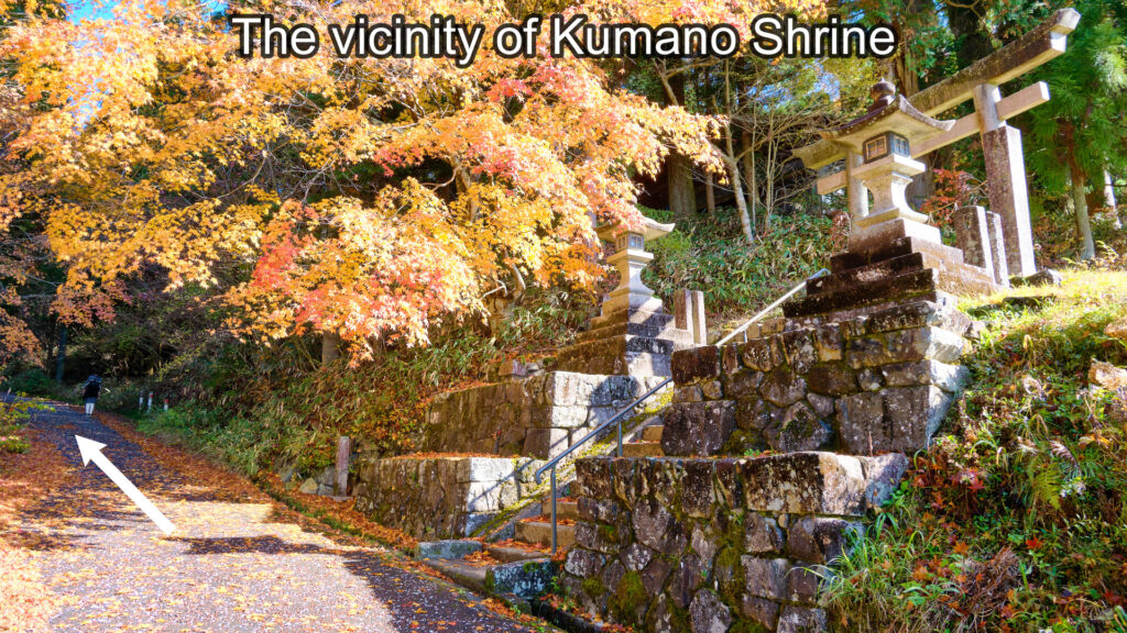
The vicinity of Kumano Shrine
"Village On The Pass" Juncture 2
41-minute walk from the southern tip of Magome-Juku.
Turn onto the prefectural road and go straight.
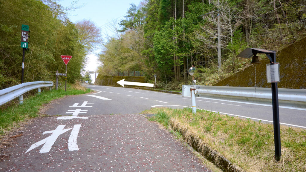
"Village On The Pass" Juncture 2
The top of Magome Pass
43-minute walk from the southern tip of Magome-Juku.
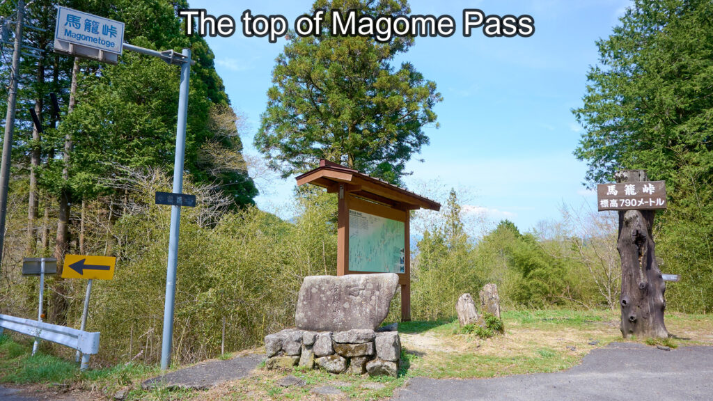
The top of Magome Pass
The tea house on the right of the following photo is called "Tougenochaya". There is a downhill next to the signboard on the left of the following photo.
Turn off the prefectural road onto the hill and go down the hill.
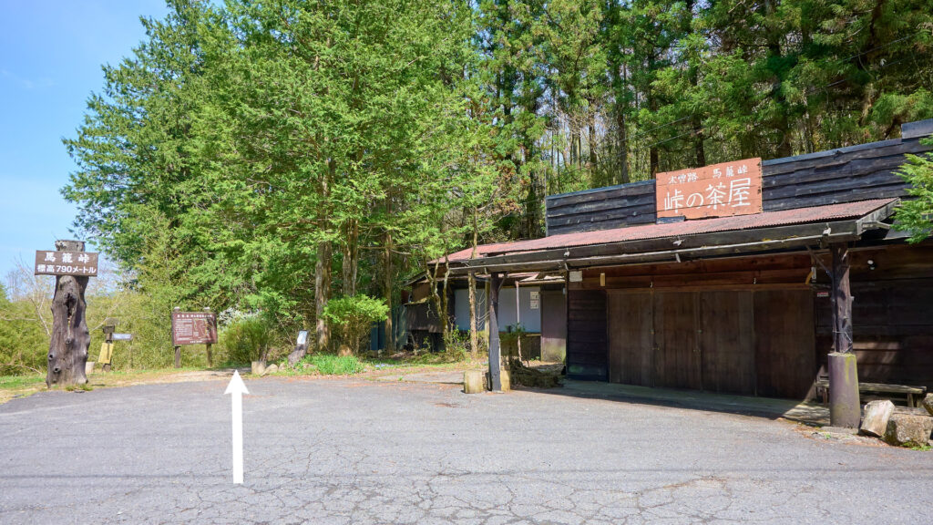
Toge Chaya
Ichikokutochi Tatebachaya
55-minute walk from the southern tip of Magome-Juku.
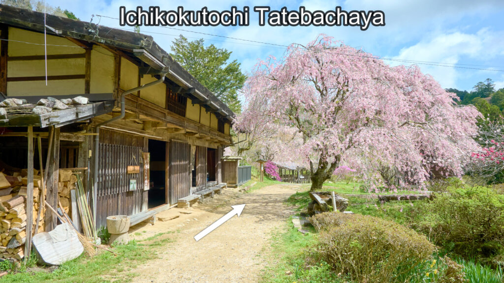
Ichikokutochi Tatebachaya
The vicinity of Ichikokutochi Shiraki Aratame Bansyo
It's close to Ichikokutochi Tatebachaya.
Go straight, pass through the gate and go along the path.
(FYI: Turn left and walk 60 meters. Then, you'll find Koyasu Kannon and the weeping cherry tree.)
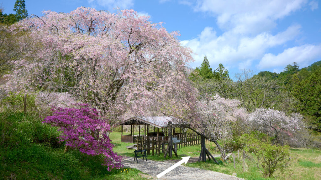
The vicinity of Ichikokutochi Shiraki Aratame Bansyo
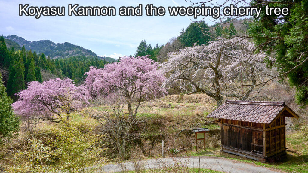
Koyasu Kannon and the weeping cherry tree
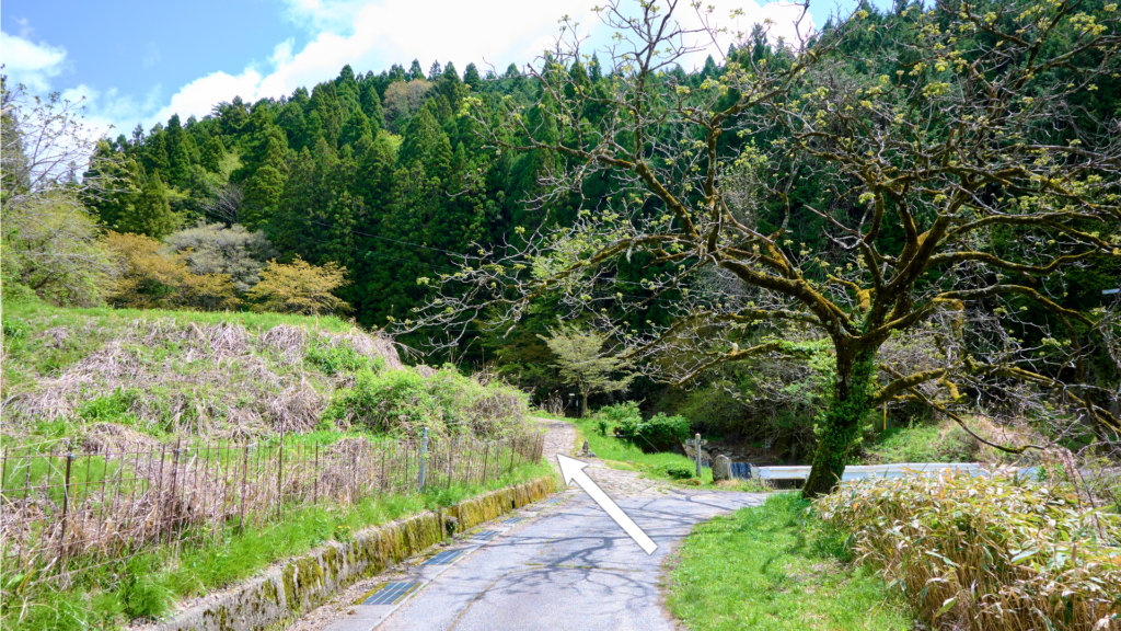
Kamoigi
60-minute walk from the southern tip of Magome-Juku.
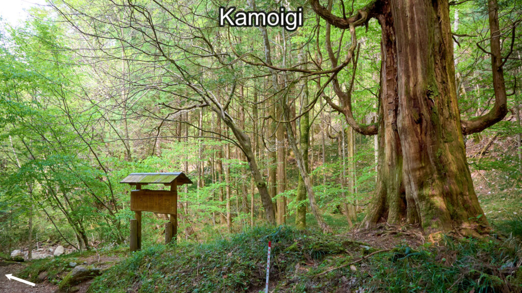
Kamoigi
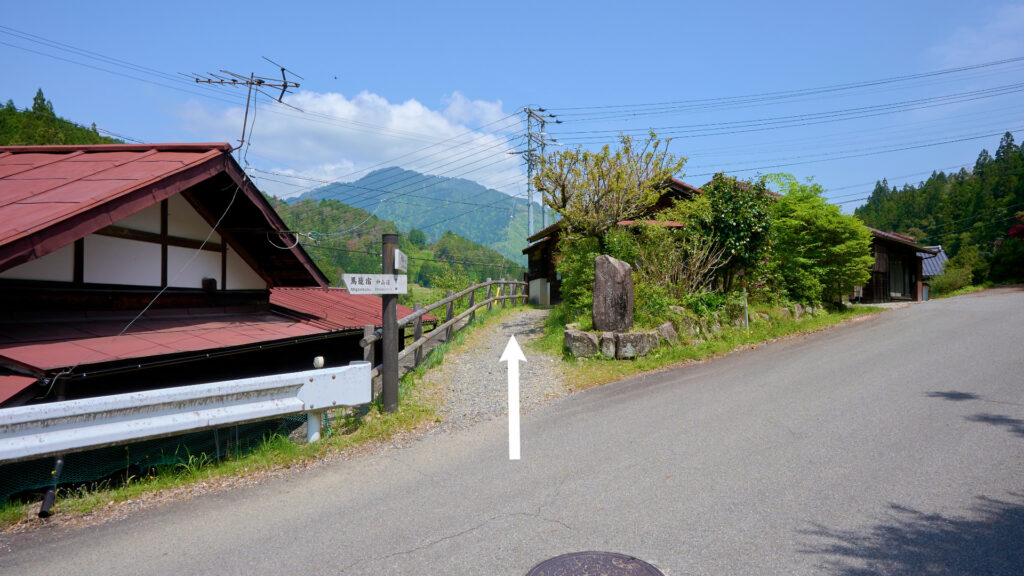
"Entrance To The Pass" Juncture
62-minute walk from the southern tip of Magome-Juku.
There is a downhill at the gap between the guardrails in the following photo.
Go straight and go down the hill. (Don't go along the prefectural road.)
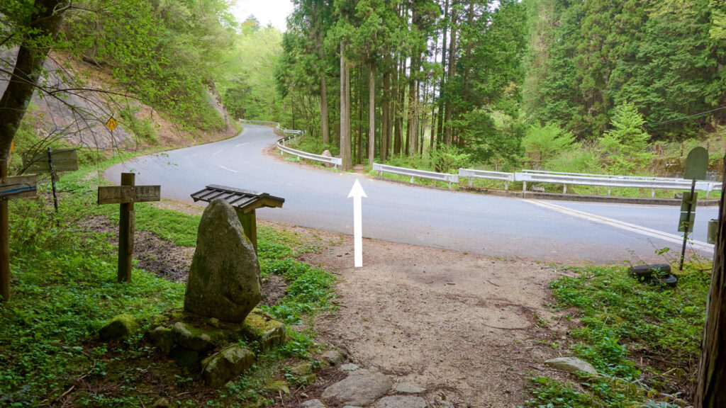
"Entrance To The Pass" Juncture
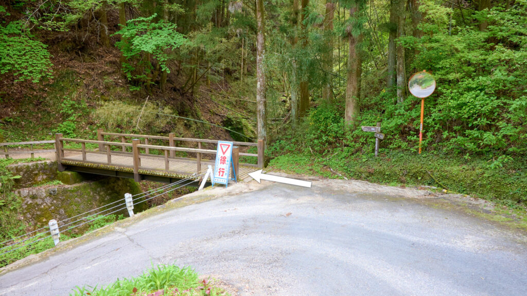
The bridge around Odarudaki
66-minute walk from the southern tip of Magome-Juku.
Cross the bridge. After crossing the bridge, you'll come to the prefectural road. Then turn left.
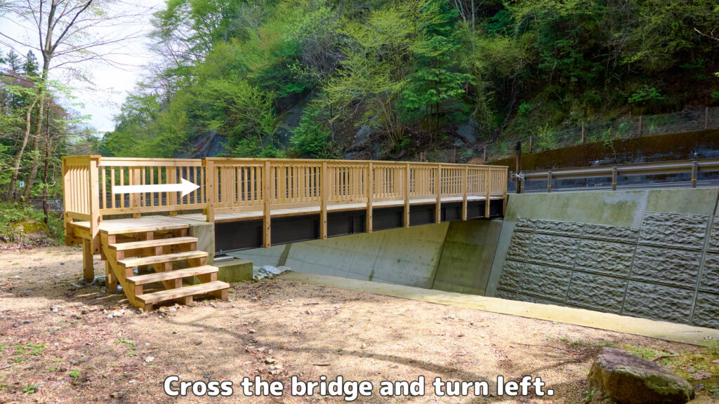
The bridge around Odarudaki
Odarudaki Juncture 1
68-minute walk from the southern tip of Magome-Juku.
Turn off the prefectural road onto the right path.
Odarudaki Juncture 1
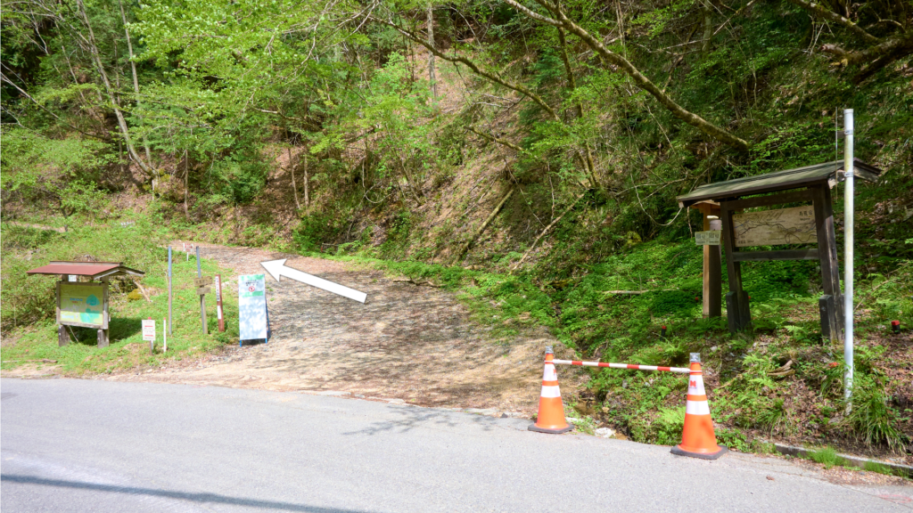
Odarudaki Juncture 2
75-minute walk from the southern tip of Magome-Juku.
Turn onto the paved-path and go straight. (FYI: Turn onto the paved-path and go along the path in the opposite direction. Then, you'll find a bridge. Cross the bridge and turn left immediately. After that, you'll find Odaki Waterfall. It takes about 3 minutes from here. Medaki Waterfall is near Odaki Waterfall.)
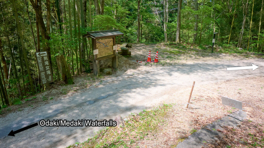
Odarudaki Juncture 2
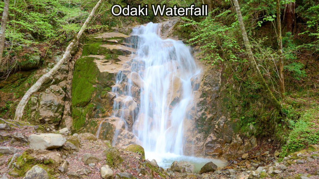
Odaki Waterfall
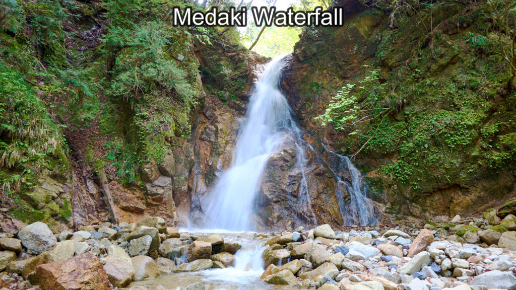
Medaki Waterfall
Kurashina Shrine
78-minute walk from the southern tip of Magome-Juku.
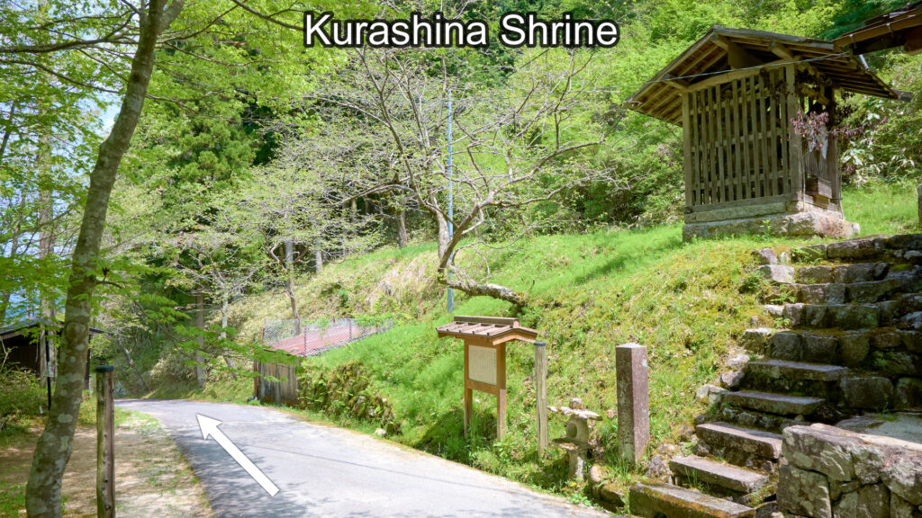
Kurashina Shrine
The bridge around Kudaritani
81-minute walk from the southern tip of Magome-Juku.
Cross the bridge and go along the path.
The bridge around Kudaritani
The terraced rice paddies around Kudaritani
83-minute walk from the southern tip of Magome-Juku.
Go straight. (Don't go up the right hill.)
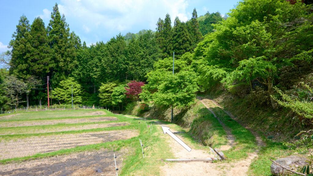
The terraced rice paddies around Kudaritani
The Gyuto Kannon (stone buddha) around Kudaritani
85-minute walk from the southern tip of Magome-Juku.
There is Gyuto Kannon close to the signboard on the right of the following photo.
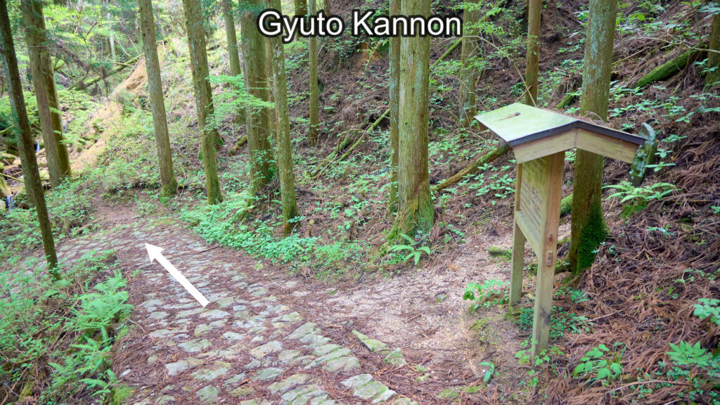
Gyuto Kannon
Kudaritani Juncture
85-minute walk from the southern tip of Magome-Juku.
Turn onto the prefectural road and turn right. (Go across the crosswalk and walk on the left sidewalk.)
Kudaritani Juncture
Koshin Mound Juncture
85-minute walk from the southern tip of Magome-Juku.
Turn off the prefectural road onto the left path.
There is Koshin Mound in the middle of the following photo.
Koshin Mound Juncture
Otsumago Juncture 1
91-minute walk from the southern tip of Magome-Juku.
Go straight.
Otsumago Juncture 1
Hatago in Otsumago
92-minute walk from the southern tip of Magome-Juku.
Hatago means Japanese inn in the Edo period.
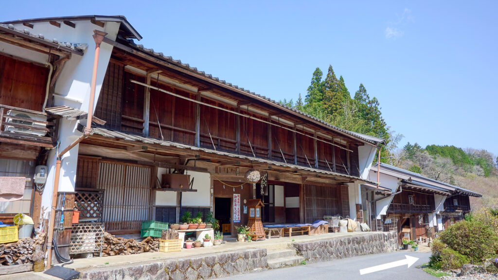
Hatago in Otsumago
Otsumago Juncture 2
93-minute walk from the southern tip of Magome-Juku.
Cross the bridge and turn left immediately.
Otsumago Juncture 2
Otsumago Juncture 2
Shinmei Bridge Juncture
95-minute walk from the southern tip of Magome-Juku.
Go along the left path.
Shinmei Bridge Juncture
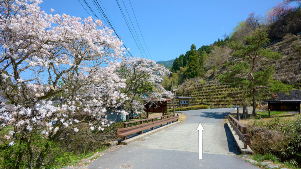
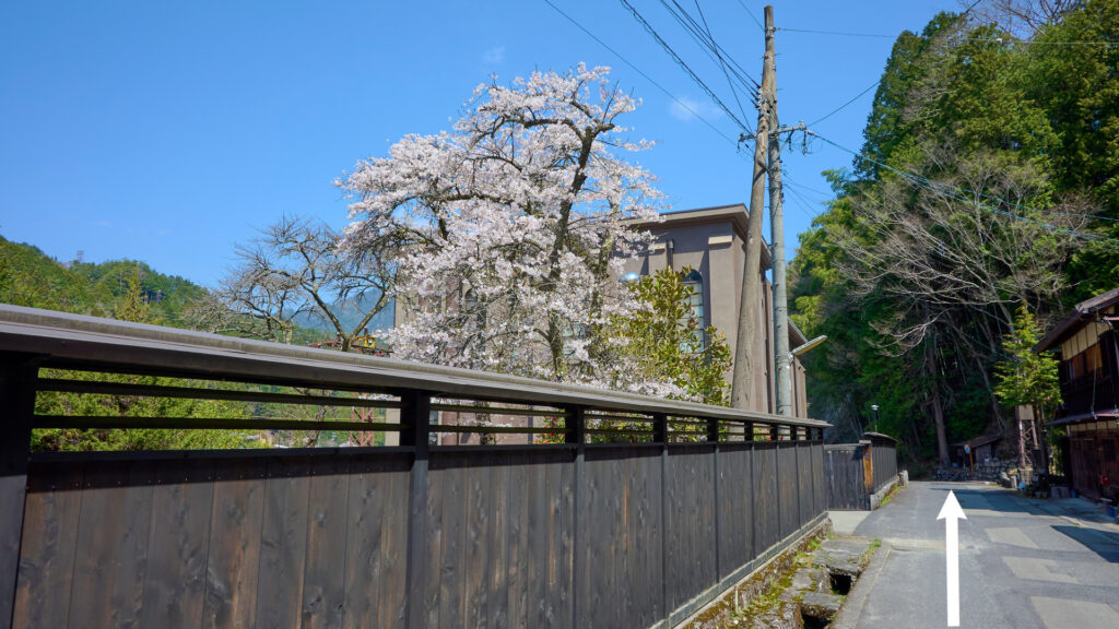
Otsuma Bridge Juncture 1
100-minute walk from the southern tip of Magome-Juku.
Turn onto the paved-road and turn left.
Otsuma Bridge Juncture 1
Otsuma Bridge
It's close to Otsuma Bridge Juncture 1.
Cross the bridge.
Otsuma Bridge
The vicinity of the stone signpost
It's close to Otsuma Bridge.
Go straight. (FYI: There is an alley at the gap between the bridge-rail and the guardrail. Turn into the alley and walk a little. Then, you'll find a stone signpost.)
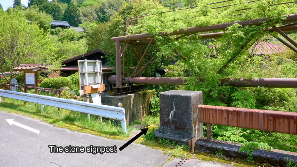
The vicinity of the stone signpost
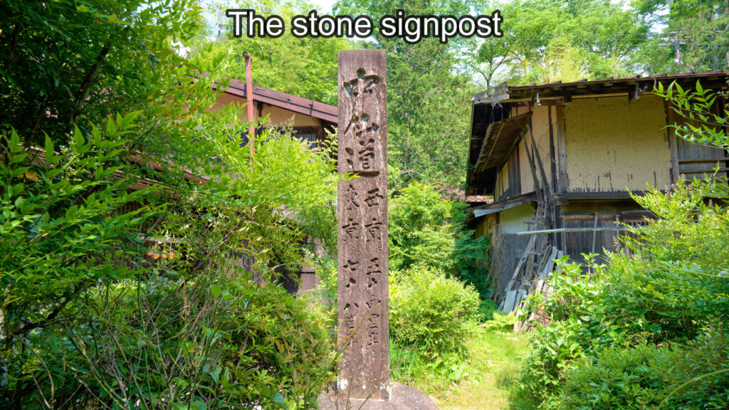
The stone signpost
Otsuma Bridge Juncture 2
101-minute walk from the southern tip of Magome-Juku.
Turn off the paved-road onto the left path and go along the path. (The path is in the middle of the following photo.)
Otsuma Bridge Juncture 2
Tajima Bridge Juncture
105-minute walk from the southern tip of Magome-Juku.
Tajima Bridge is on the left of the following photo. (It's hidden by the trees.)
Go straight.

Tajima Bridge Juncture
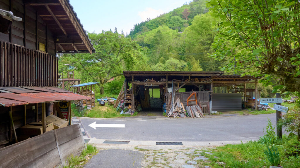
Tsumago Power Station
108-minute walk from the southern tip of Magome-Juku.
Tsumago Power Station
Tsumago Juncture 1
It's near Tsumago Power Station.
Go straight.
Tsumago Juncture 1
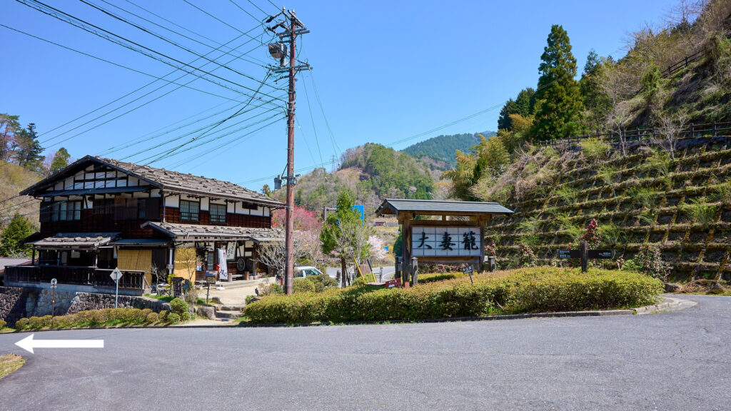
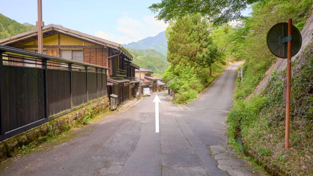
The southern tip of Tsumago-Juku
110-minute walk from the southern tip of Magome-Juku.
Go straight.
The southern tip of Tsumago-Juku
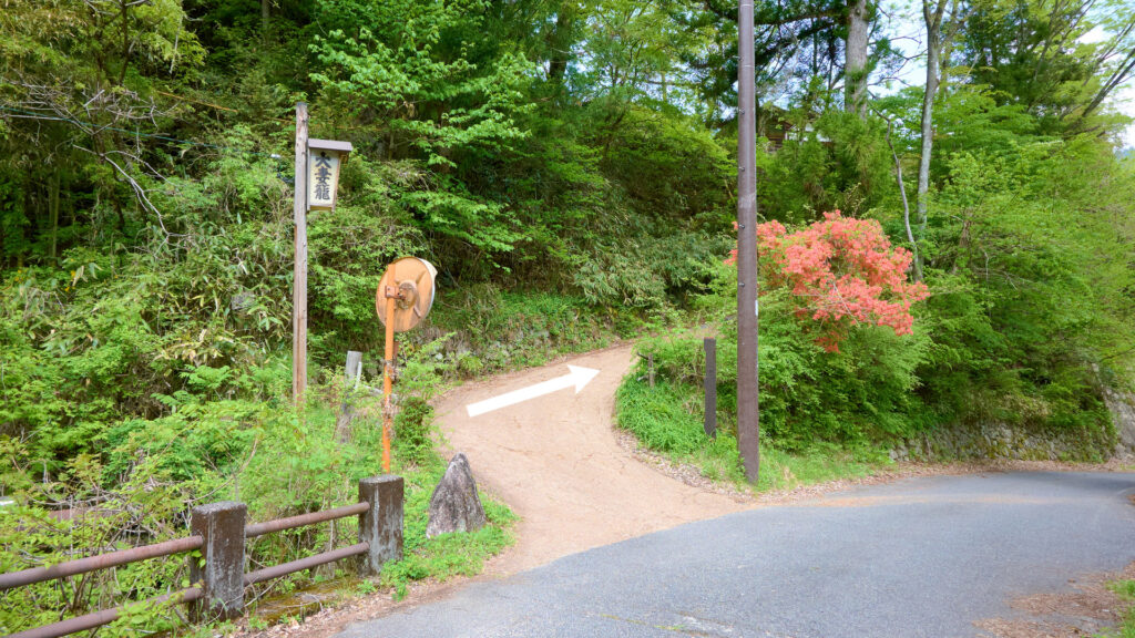
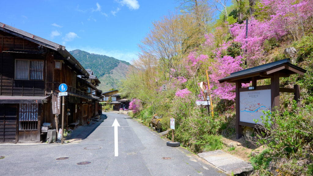
The vicinity of Kamisagaya
111-minute walk from the southern tip of Magome-Juku.
The house on the right of the following photo is called "Kamisagaya".
The vicinity of Kamisagaya
The vicinity of Tsumago-Juku Masugata
112-minute walk from the southern tip of Magome-Juku.
Bear left. (Turn onto the path at the bottom left of the following photo.)
The vicinity of Tsumago-Juku Masugata
Tsumago Lovers Office
113-minute walk from the southern tip of Magome-Juku.
Turn left.
Tsumago Lovers Office
The vicinity of Tsumago-Juku Honjin
114-minute walk from the southern tip of Magome-Juku.
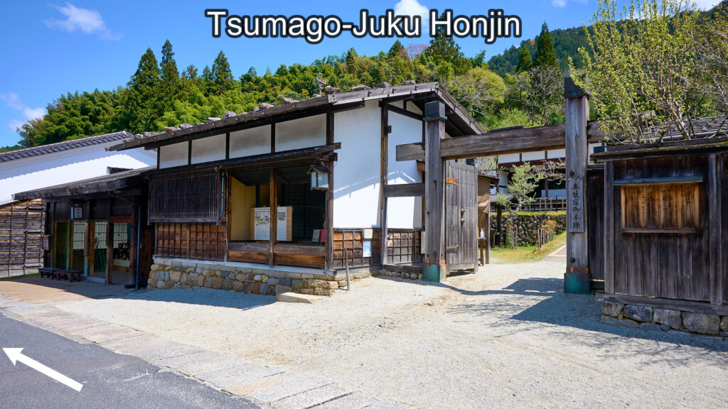
Tsumago-Juku Honjin
The vicinity of Tsumago-Juku Waki-Honjin
115-minute walk from the southern tip of Magome-Juku.
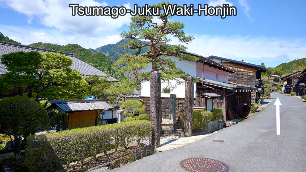
Tsumago-Juku Waki-Honjin
Tsumago Bus Stop Juncture
116-minute walk from the southern tip of Magome-Juku.
Go straight. (FYI: Turn left and walk a few minutes along the path, then you'll find Tsumago Bus Stop.)
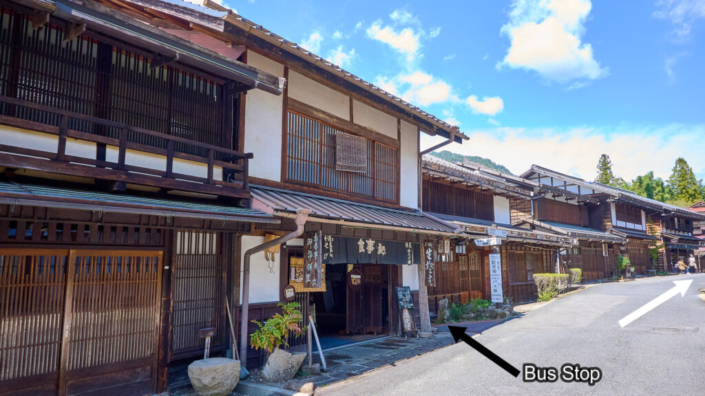
Tsumago Bus Stop Juncture
The northern tip of Tsumago-Juku
117-minute walk from the southern tip of Magome-Juku.
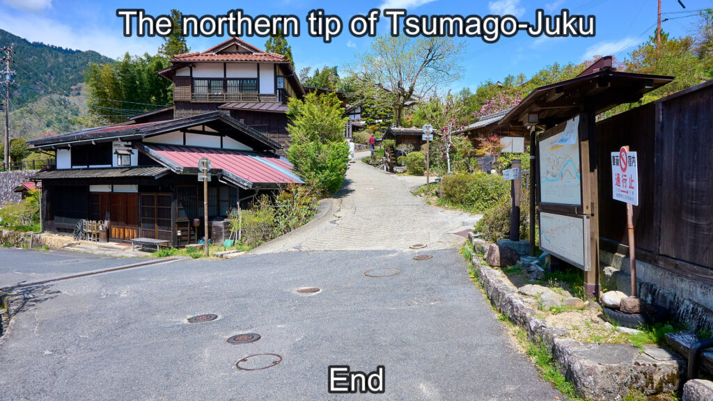
The northern tip of Tsumago-Juku